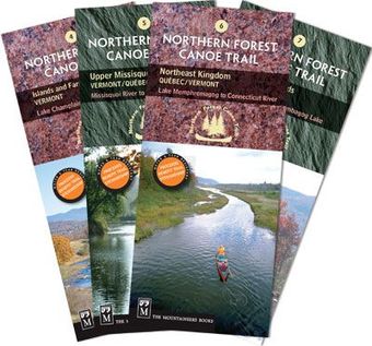
Pastoral river valleys, quickwater runs, meandering oxbows, big lakes, and, perhaps, a great blue heron as your guide.
The Northern Forest Canoe Trail through Vermont, Québec, and New Hampshire is diverse and scenic packed with big lake crossings and meandering rivers. Though day trippers tend to avoid Quebec's 5.7-mile Grand Portage—the trail's longest carry—enthusiasts can find petroglyphs along this ancient Native American portage route.
Map set includes:
Map 4: ISLANDS AND FARMS REGION, Vermont, Lake Champlain and Missisquoi River
Map 5: UPPER MISSISQUOI VALLEY, Vermont/Quebec, Missisquoi River to Lake Memphremagog
Map 6: NORTHEAST KINGDOM, Quebec/Vermont, Lake Memphremagog to Connecticut River
Map 7: GREAT NORTH WOODS, New Hampshire, Connecticut River to Umbagog Lake
Details per map:
• Scale: 1:1,000,000 (1″ = 1.6 miles)
• Contour interval = 20m/60ft
• Folded size (4″ x 9.25″)
• Unfolded size (18.5″ x 24″)
Experience the rest of the longest water trail in the nation!
The Northern Forest Canoe Trail is divided into 13 sections, and each section has its own map with both route and interpretive information. See all maps here.


