Downloadable Map: Magalloway
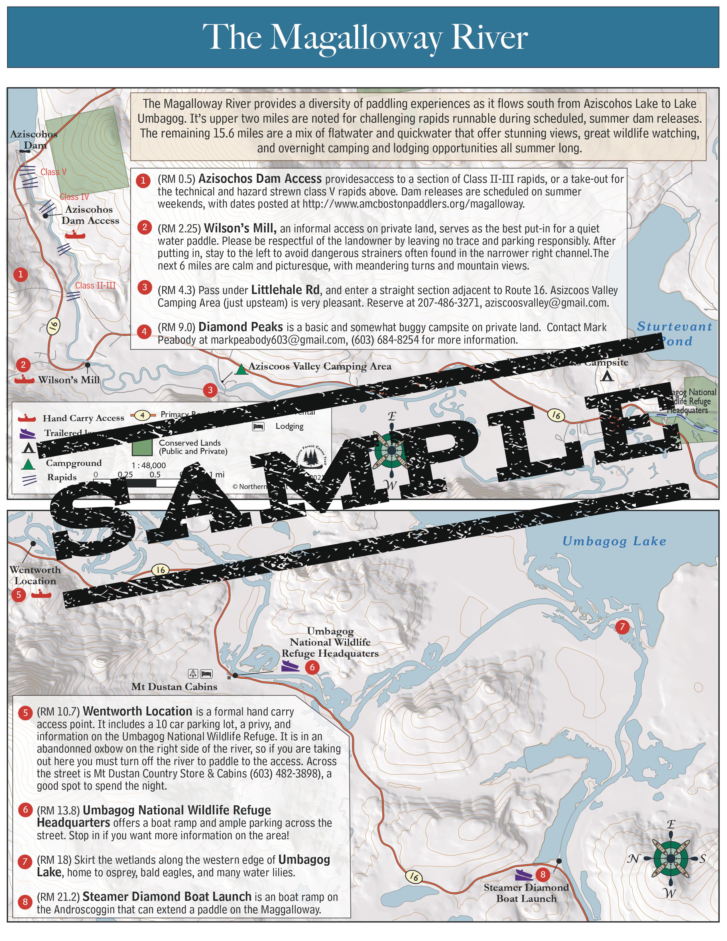
The Magalloway River provides a diversity of paddling experiences as it flows south from Aziscohos Lake to Lake Umbagog. It’s upper two miles are noted for challenging rapids runnable during scheduled, summer dam releases. The remaining 15.6 miles are a mix of flatwater and quickwater that offer stunning views, great wildlife watching, and overnight camping and lodging opportunities all summer long.
This map is free to members! To become a member, click here.

