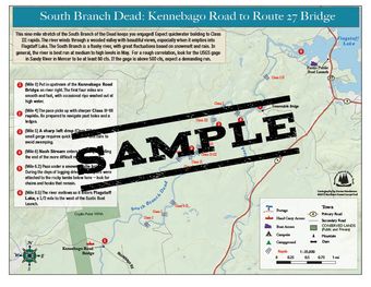
This nine mile stretch of the South Branch of the Dead keeps you engaged! Expect quickwater building to Class III rapids. The river winds through a wooded valley with beautiful views, especially when it empties into Flagstaff Lake. The South Branch is a flashy river, with great fluctuations based on snowmelt and rain. In general, the river is best run at medium to high levels in May. For a rough correlation, look for the USGS gage in Sandy River in Mercer to be at least 80 cfs. If the gage is above 500 cfs, expect a demanding run.
This map is free to members! To become a member, click here.


